Satellite Images Reveal Possible Russian Undersea Cables In Crimea
CLICK to Enlarge
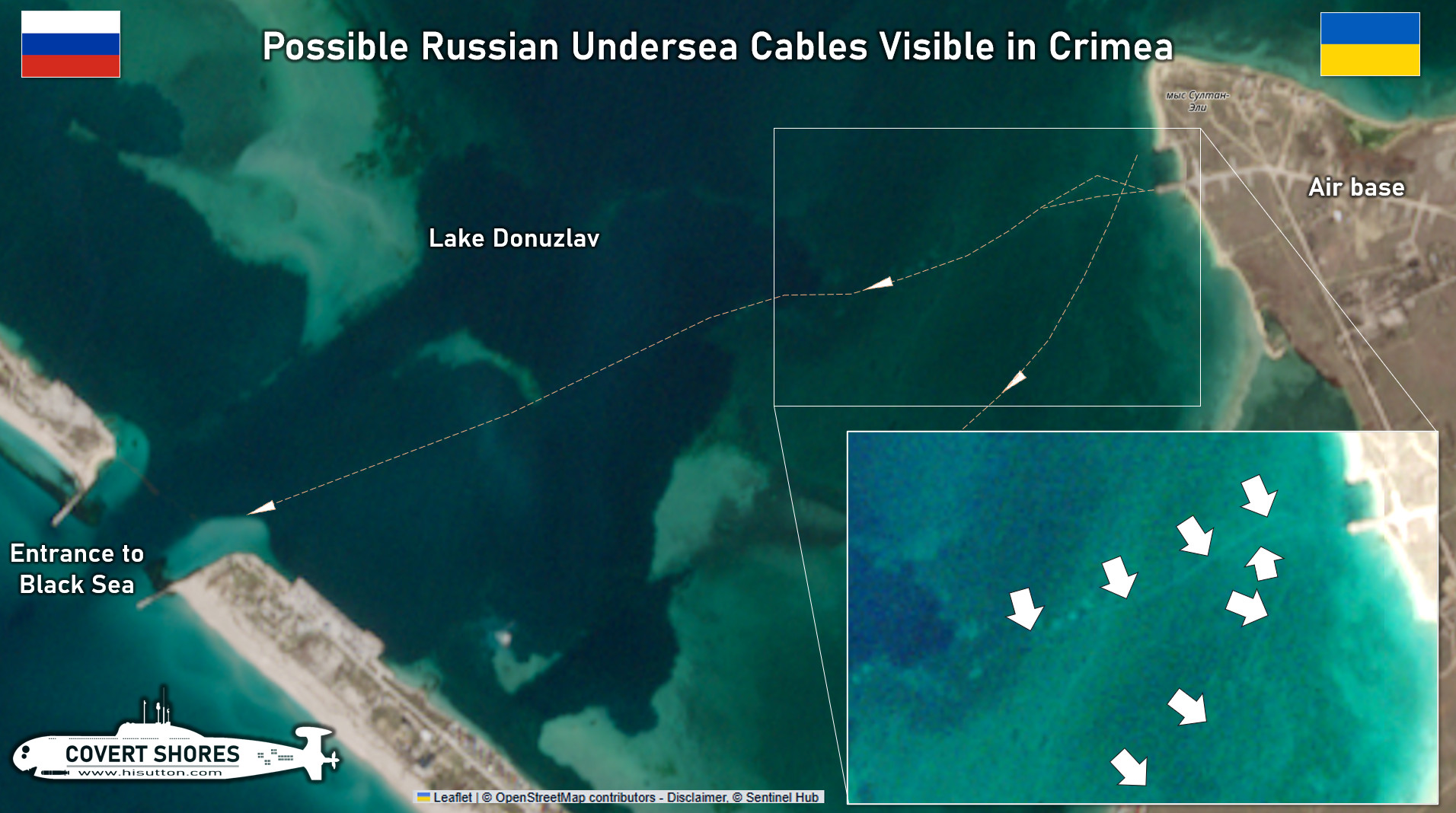
 Recent weather conditions have revealed previously not visible marks on the seabed in Lake Donuzlav on the western coast of Crimea. Several marks leave boat ramps leading to Donuzlav Air Base and trace their way towards the narrow entrance to the Black Sea. The unusual lines are visible on multiple satellite images.
I have been considering these lines for some time. The most plausible explanation seems to be that they are undersea cables. They do not appear to be scaring from boat keels or floating booms being brought ashore, and they do not appear to be natural phenomenon.
The marks are not ordinarily visible. It appears that weather conditions, light conditions and shallow water levels are playing a part in exposing this ordinarily unseen detail.
The cables may relate to offshore infrastructure such as the gas platforms (which are also used by Russia for surveillance) or to undersea hydrophones. Or they may be for power or communications.
Related articles (Full index of popular Covert Shores articles)
 Guide to Russia’s naval drones (USVs)

 Guide to Ukraine’s naval drones (USVs)

 Guide To Iran’s Navy & IRGC Drone Carriers And Similar Large Ships submarine w/Cutaway
 Ukraine’s long-ranged attack drones (OWA-UAVs)