OSINT_Webcams
Analysis of submarine operating patterns and capabilities using public webcams
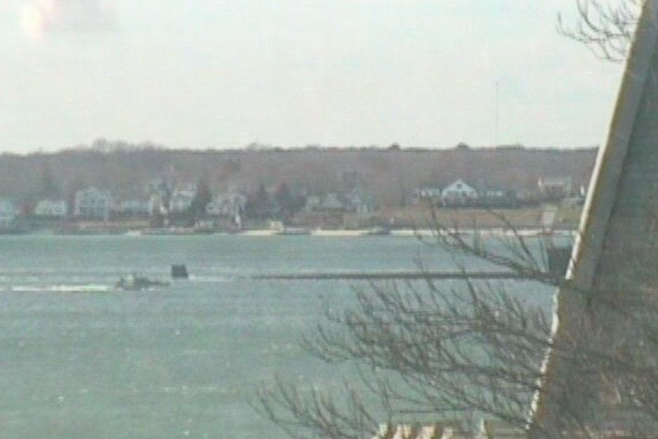
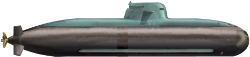
A US Navy nuclear powered attack submarine passes a publicly viewable webcam.
Submarines invariably operate under tight operational security (OPSEC). When at sea, they create an intangible and illusive threat which ties up considerable enemy resources to counter, fearing a strategic blow at any moment. But they are at their most vulnerable in port where they cannot sink beneath the surface to hide. Consequently, their comings and goings are rarely reported, especially at times of heightened tension.
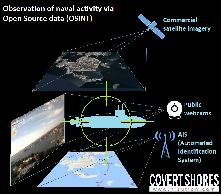
 The recent Open Source Intelligence (OSINT) revolution has seriously eroded the secrecy which can be expected however. Fueled by the Information age and, increasingly, the AI revolution, OSINT provides many ways to track certain elements of submarine operations, principle the time they spend in port. This is significant because it can reveal operating patterns, readiness levels, procedures and routes, indicators of movement and, potentially changes in readiness status. During times of tension some OSINT sources may provide real-time or near real time indicators of action or inaction, of strength or vulnerability.
OSINT refers to using data from publicly available sources for intelligence purposes.
To an extent OSINT is democratizing the intelligence arena. Countries or non-state actors can gain some useful intelligence without the investment or risks associated with traditional intelligence means such as reconnaissance aircraft, military satellites, listening posts (SIGNIT) or spies on the ground. And OSINT has increasingly been explored by private individuals and companies, for example by defense analysts.
In many countries years of defense cuts have exasperated the problem. The trend towards consolidating ever smaller submarine fleets at one or two naval bases makes them easier to keep an eye on. And locating those bases in populated areas, where publicly viewable webcams are most likely, increases the risk further.
If it is possible to for a foreign power to monitor comings and goings from a naval base they can build up a detailed picture of when submarines are present and when they are at sea:
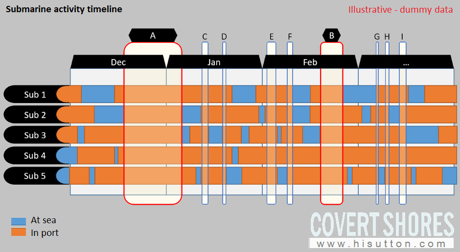
This could be used to answer a number of questions:
-
Are there extended periods when no subs are at sea? (A, B above)
-
What are the deployment patterns around national holidays, naval days etc? It may be possible to predict when fewest submarines are at sea and time operations accordingly, e.g. a surprise attack while the submarines are in port and the submariners are home on national holidays
-
What are the weekday-weekend patterns?
-
Are there shorter periods where all submarines are in base? Are there leading indicators of this?
-
Are some subs less active? Does this mean that they are unreliable or simply at lower readiness?
-
How many at-sea days do crews get? Are they well trained?
-
Are submarines exercising together?
-
How prepared are the crews for extended operations?
-
….

The ultimate book of Special Forces subs Covert Shores 2nd Edition is the ONLY world history of naval Special Forces, their missions and their specialist vehicles. SEALs, SBS, COMSUBIN, Sh-13, Spetsnaz, Kampfschwimmers, Commando Hubert, 4RR and many more.
Check it out on Amazon
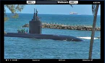
Example webcam: Swedish submarine base
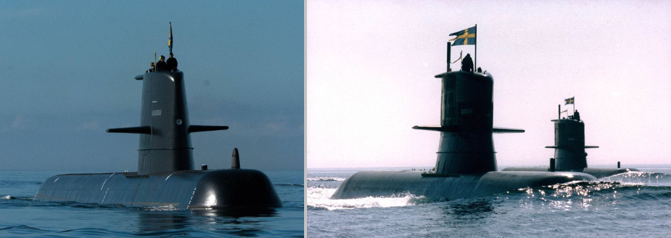
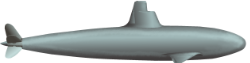
Swedish Gotland Class (left) and Södermanland Class (right) AIP submarines
 Sweden’s entire fleet of five highly potent AIP (Air Independent Power) submarines are home-ported in Karlskrona on the Baltic coast.
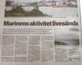
On the 24th July 2017 a Swedish newspaper let the world in on the webcam ‘secret’ when they ran a story describing how a camera run by the local council is overlooking Sweden’s main naval base at Karlskrona. The webcam is viewable at webbkameror.se.
“Navy’s activities live-streamed! Councils Visit Karlskrona website has webcams overlooking harbour. Navy has asked council to stop, without result”
We shall use this as the case study because the media has already highlighted the concern here. There are numerous other locations where something very similar is also possible.
The local authority appears to have determined, without Navy input, that the camera is too low resolution to be of use to a opposing force. From the article:
*The municipality’s tourist manager Terje Pedersen claims to have not been informed of any complaints from the Naval Base. “As the world today looks like, I would say that our cameras are pretty innocent,” he says.
Terje Pedersen explains that the municipality did not contact the Armed Forces when setting up the cameras, but on the other hand they underwent a big process of being set up.
These cameras are under the Personal Protection Act and it is strict. There are no possibilities to zoom in on these types of cameras and they are quite low-resolution, probably because of just the reason that nothing can be read.*
In fact the low resolution is only a minor annoyance for OSINT analysts. Although, on its own, the webcam view does not allow identification of which vessel is moving (except in cases where the vessel is large and distinct, for example an aircraft carrier or TYPHOON Class submarine), it provides a useful part of a larger picture. When combined with other OSINT sources the sum of the whole becomes greater than the parts and a lot of information can be gleamed from the blurry images.
Webcams. Publicly accessible Webcams are widely seen as a public service and may be set up to show traffic or weather in a specific location, to promote tourism, or as an educational project. In general they offer relatively low quality imagery but are usually live streaming, or at least frequently updated. Some are archived and a few allow the public to control their direction, elevation, zoom etc. All are susceptible to being monitored and recorded by OSINT analysts for reasons other than their intended purpose.
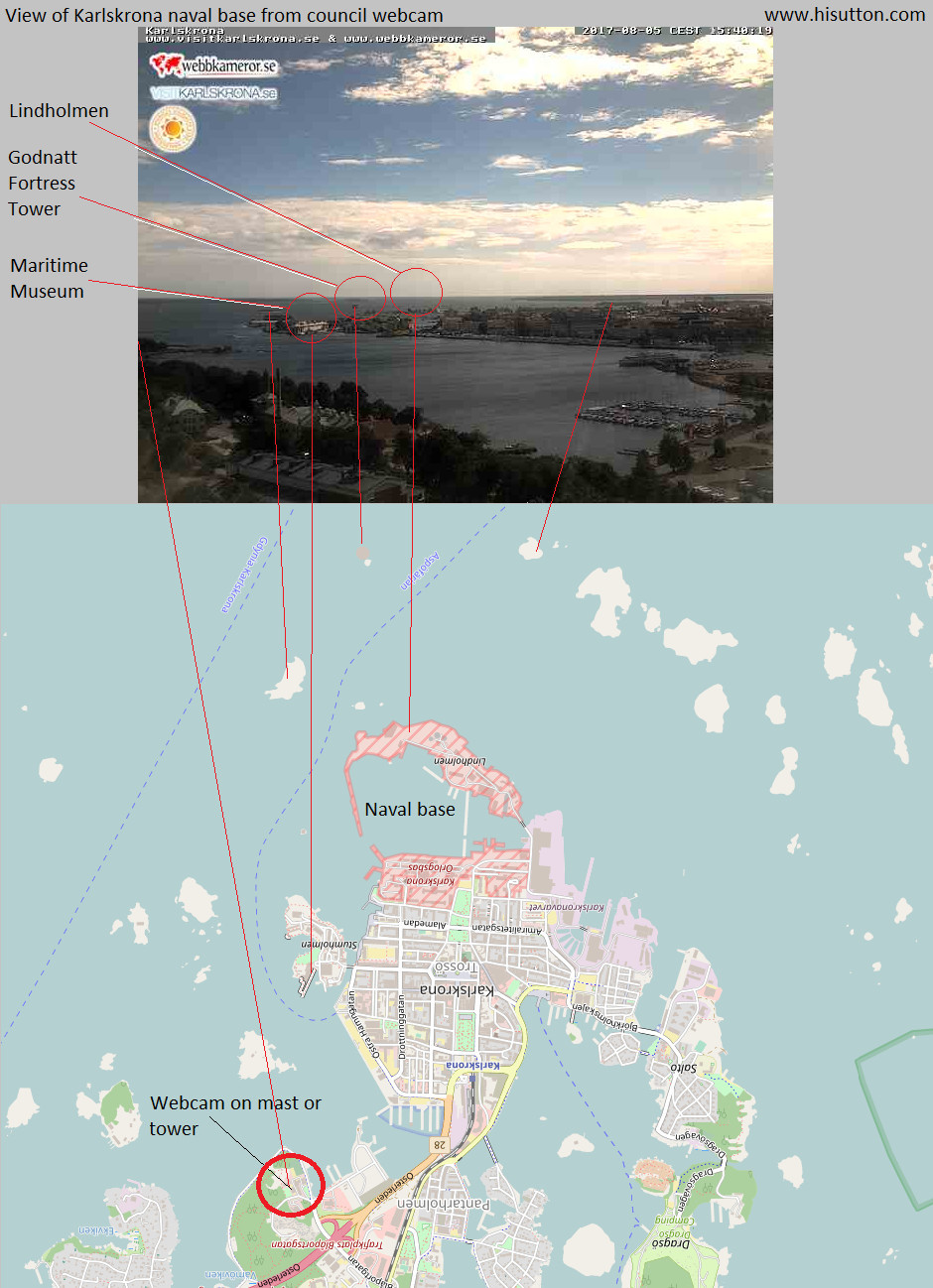
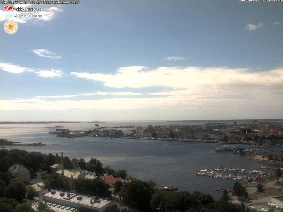
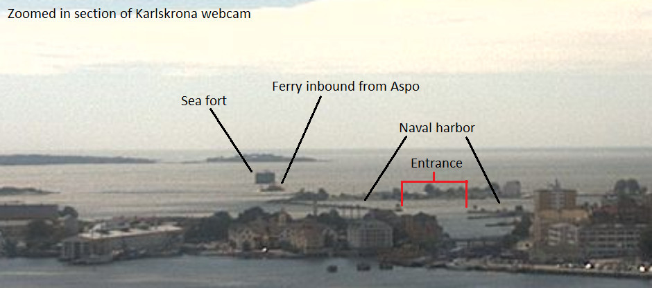
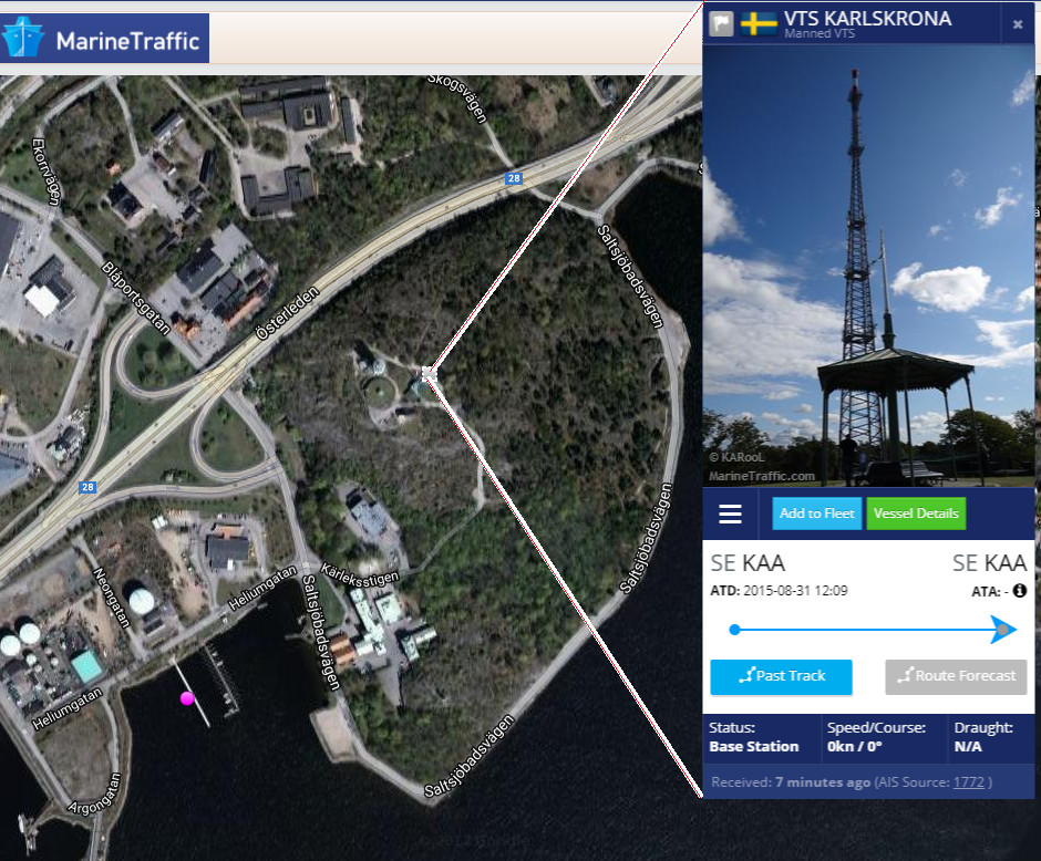
Location and approximate field of view of the Karlskrona webcam. Below is its probable location which is also an AIS tower (see below):
Webcams tend to be less useful during nighttime hours (although navigation lights may still be visible) but generally work 24 hours a day meaning that early morning returns to port are captured while the rest of the world sleeps.
AIS. Vessels broadcast their location on Automatic Identification System (AIS) to avoid collision and aid rescue efforts in the event of an accident. The International Maritime Organization’s International Convention for the Safety of Life at Sea requires all international voyaging ships over 300 tons, plus all passenger ships (regardless of size) to carry it. Additionally, many pleasure craft and working boats (e.g. pilot launches) carry it voluntarily. The system broadcasts the vessel’s position, speed, heading, destination, cargo (sometimes), name/ID etc.
Naval vessels are not required to have it and often switch it off for operational reasons. It is sometimes used when operating in busy shipping lanes or near ports, but it is rarely switched on and sometimes presents deceptive or ambiguous information about the vessel’s identity (e.g. “US Submarine”).
Counterintuitively, the absence of AIS broadcasting can actually work in the OSINT analyst’s favor. If you can see something large on the public webcam that is not on AIS then it is probably interesting.
OSINT analyst Steffen Watkins (Twitter / Vessel of interest blog) has shown several ways in which AIS can be used to track submarines and surface vessels – what is revealed here and on his blog is only scratching the surface.
Here I am using Marine Traffic but other providers include IHS Markit (AIS Live) and Lloyd’s List Intelligence.
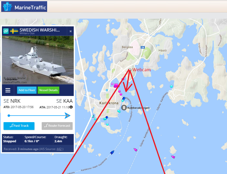
AIS snapshot of Karlskrona viewed via MarineTraffic.com
Commercial satellite imagery. The classic OSINT source, satellites take high-quality top-down images which can be extremely revealing. Although some operational information can be derived, they are generally too infrequent to reveal patterns. There are many tools for viewing satellite images and OSINT analysts tend to look at the same location via multiple tools (Google Earth, Terraserver, Google Maps, Apple Maps) and pay providers (Digital Globe, Airbus….).
Commercial Satellite imagery is getting better quality (250mm resolution versus previously restructured 500mm resolution), and soon it will be easier to get custom images to order (for a fee). However it is still a snapshot tool.
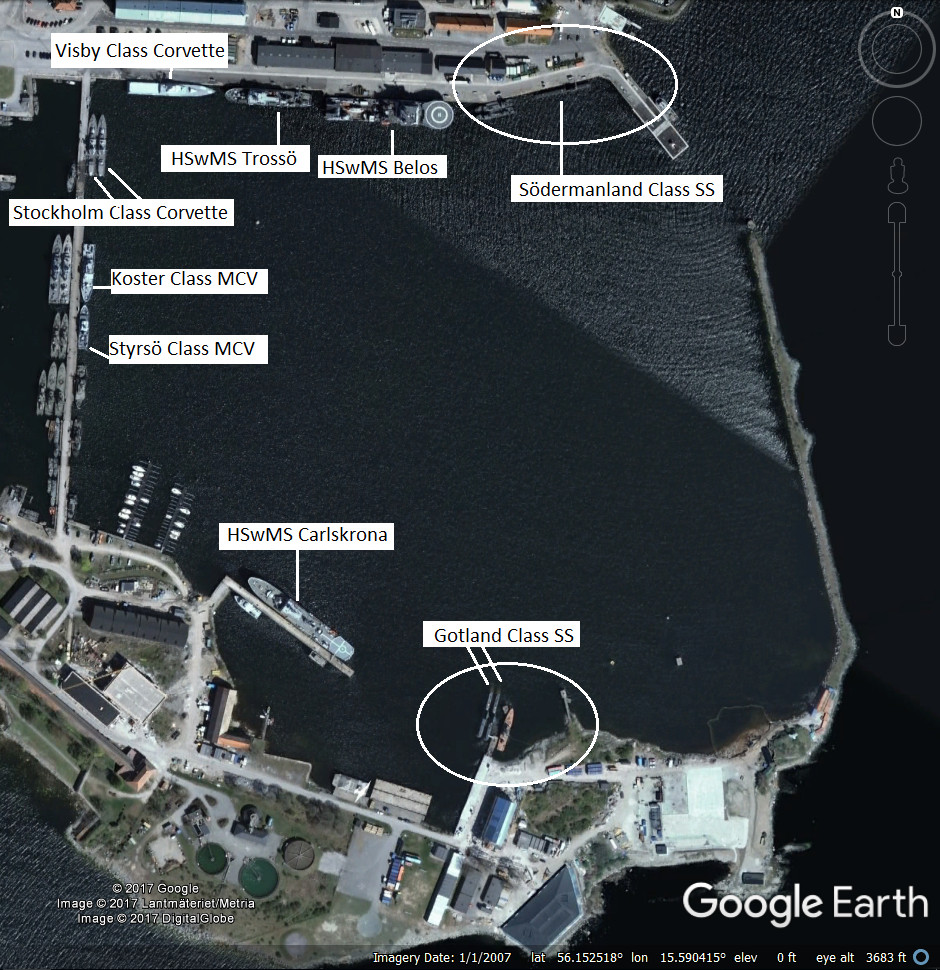
Google Earth imagery of Karlskrona naval base. Note that this is from 2007.
Satellite images are also useful for a detailed analysis of the camera’s field of view, and for establishing relative measurements of objects (e.g. submarines) relative to objects nearby (e.g. the width of the entrance to the harbor, a small island or a section of quayside).
Bringing it together. When combined, these sources paint a detailed picture of the comings and goings from the naval base. The OSINT analyst quickly becomes acquainted with the pattern of normal activities, ferry routes and schedules, lighting peculiarities and can quickly spot something unusual such as submarines coming and going.
I am going to stop short of posting the movement patterns of Swedish or NATO submarines, but it is evident from the above that it is entirely possible in many cases. Some example screen captures from recordings of the Karlskrona webcam:
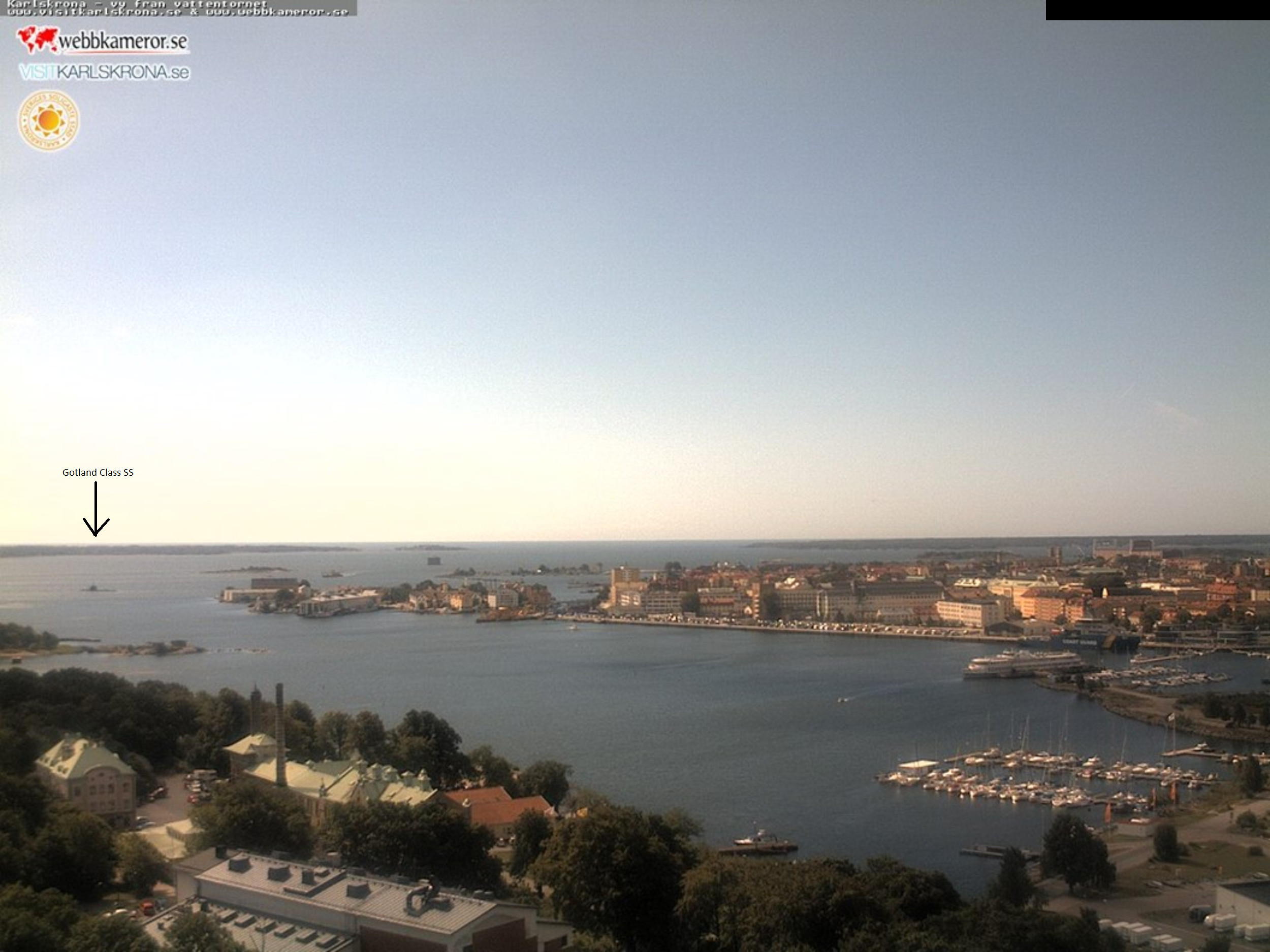
Gotland Class submarine leaving the base. CLICK for high-resolution image.
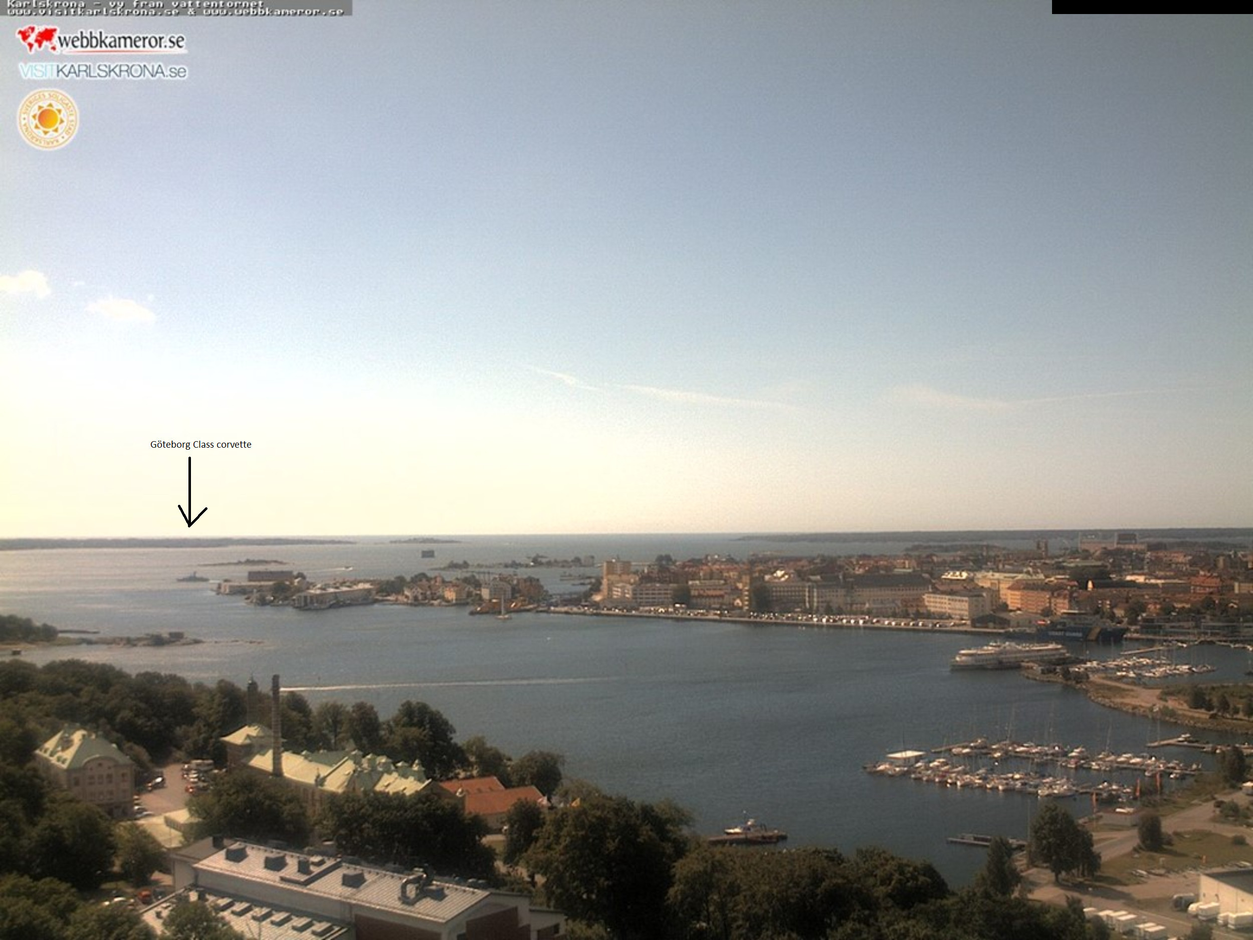
Goteborg Class Corvette leaving the base. CLICK for high-resolution image.
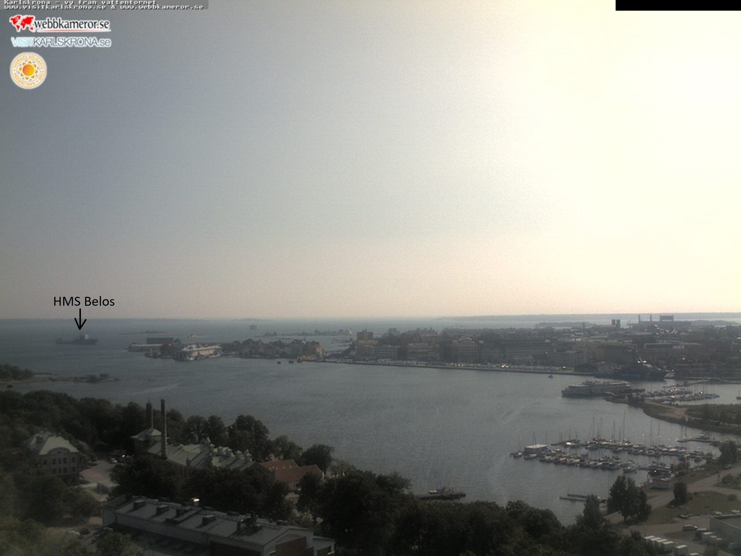
HMS Belos, Submarine Rescue ship returning to the base. CLICK for high-resolution image.
Related articles (Full index of popular Covert Shores articles)


 World survey of AIP submarines
 Sweden’s nuclear powered submarine project (A-11A)


 Yantar spy ship loitering over undersea cables
 Analysis of Swedish submarine incursion- Luleå 1983
Russia seeks submarine advantage in Arctic (SHELF system, GUGI special mission subs)