
OSINT-Chinese-Radar-Site-Naozhou-Dao
![]()

![]()
![]()
Composite image compiled by overlaying multiple satellite passes, showing radar interference. Compiled by d-atis Twitter @detresfa
OSINT Crosshairs: Pinpointing a Radar Transmitter in China
 Following on from the article on some radar transmissions being visible on SAR (Synthetic Aperture Radar) satellite imagery, here is a quick worked example.
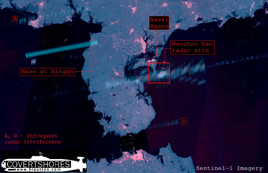
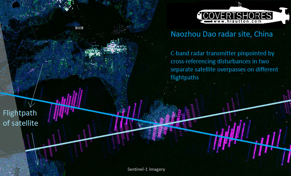
One of the areas where Sentinel-1 satellite imagery is regularly disrupted is north of Hainan in the South China Sea. The interference forms a band across the satellite image as it passes. The band is a a right-angle to the path of the satellite, running directly across the image. So we know that the transmitter is somewhere along the line of the interference. And if the satellite passes overhead on different flightpaths, where the two lines of interference cross paths is the source. In this way we can pinpoint the radar transmitter causing the interference.
Other SAR satellites are also affected, by different radars depending on their bandwidth. Sentinel-1 imagery can be accessed for free however so it is ideal to illustrate this phenomena. For a more sophisticated application of this technique, see this Twitter post by d-atis

Get The essential guide to World Submarines
This Covert Shores Recognition Guide Covers over 80 classes of submarines including all types currently in service with World Navies.
Check it out on Amazon
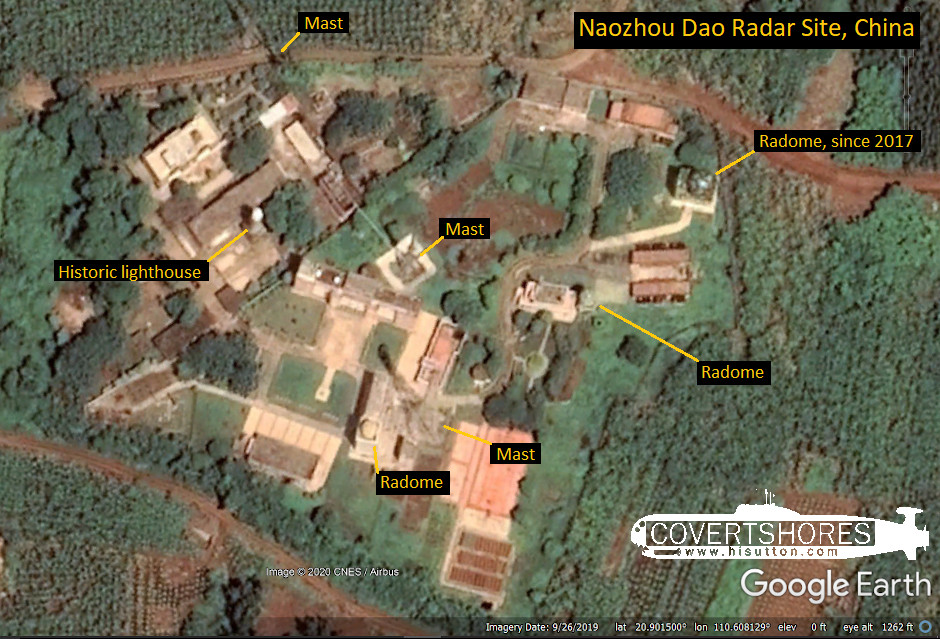
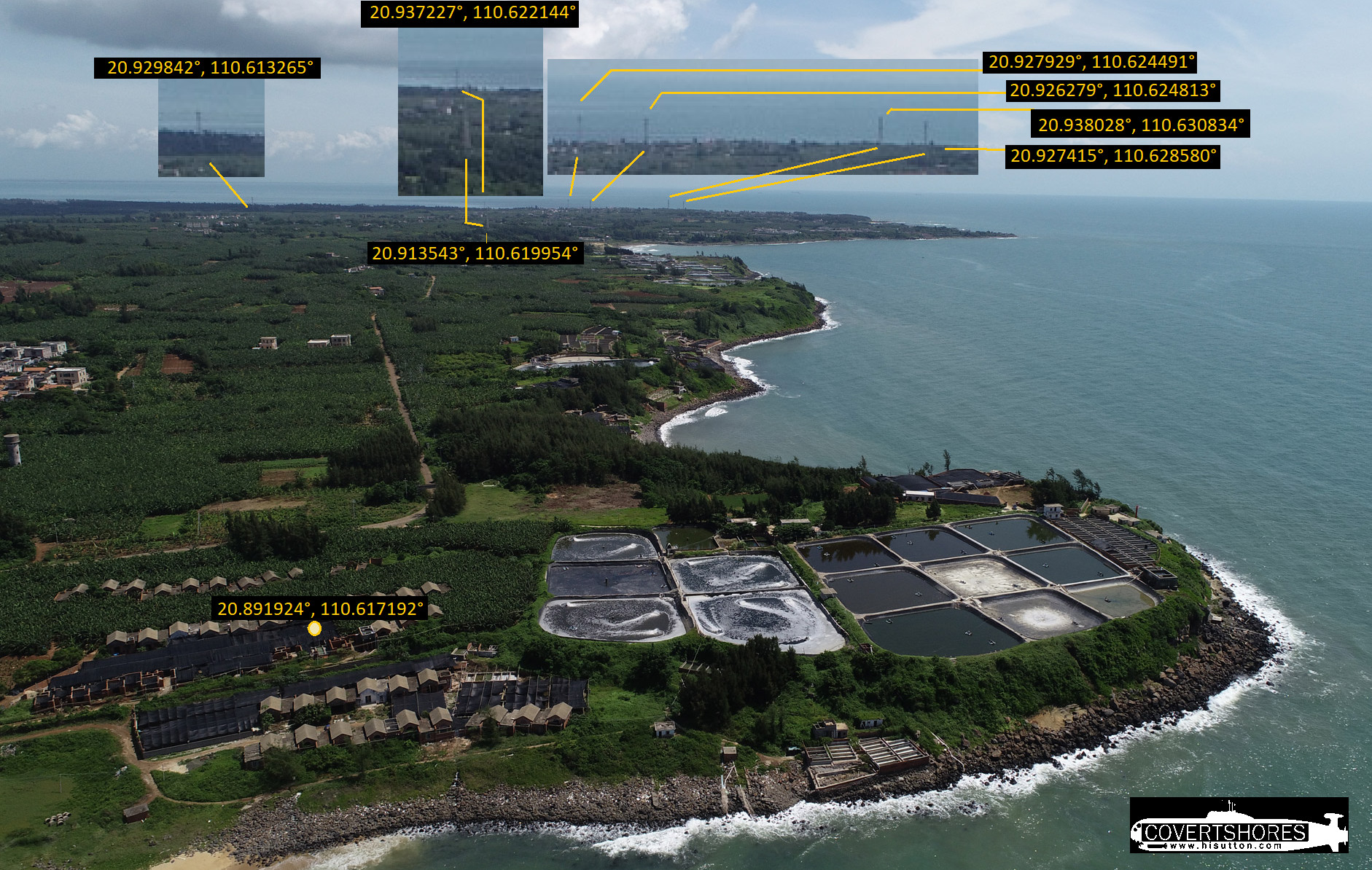
Using Google Earth (or other commercial satellite image platforms) we can quickly zero in on the source. There is a radar site on the island of Naozhou Dao at 20.901479°, 110.608121°. it is on the high ground where the historic lighthouse is. There is a new camouflaged radome in the northeast corner which has been added in recent years.
There are also several bunker complexes military sites nearby, probably closely related:
-
Camp 20.906816°, 110.603509°
-
Bunker 20.910178°, 110.602120°
-
Bunker 20.893496°, 110.592052°
-
Bunker 20.924659°, 110.618688°
-
Bunker 20.905014°, 110.587519°
Communication Masts
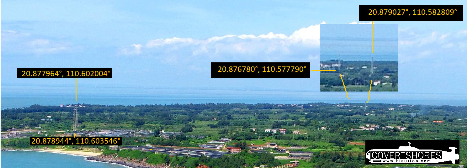
Analysis of high resolution satellite imagery (e.g. Google Earth) also shows a large number of masts on the island. These are too tall to be electricity pylons, and they are not arranged in a line at regular intervals as they would be for that. They are therefore likely to be communications antenna.
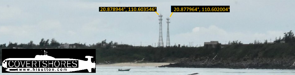
The irregular positioning of the masts, the types antennae, height & location hint at civilian use. This would be for high capacity UHF LOS commination links, and probably SCADA, GSM, TMR etc as well. It is likely that the antennas are providing a backbone link from Hainan island to the Wuchuan area.
The military could be renting space on the bearers as it’s ideal to service Hainan island. The SSF HQ is northwest of Naozhou Dao but the lack of “order” suggests non-Military communications.
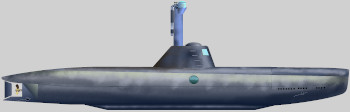
The World’s ONLY Guide to
Narco Submarines
10 years of research, analyzing over 160 incidents, condensed into a handy guide. This unique book systematically breaks down the types and families. With detailed taxonomy, recognition 3-views, profiles and photos. Available on Amazon
Many of the masts can be cross-referenced in the background of photos posted on the internet:
CLICK for HIGH-RESOLUTION image.
CLICK for HIGH-RESOLUTION image.

Covert Shores Posters, T-shirts, Mugs
and more featuring exclusive Covert Shores original artworks and design…Available on TeeSpring
This may help cover the overheads of the website
Related articles (Full index of popular Covert Shores articles)
 Chinese Type-093 Shang Class Submarine
 Chinese Sailless Submarine

 Yantar spy ship loitering over undersea cables

 Analysis of Swedish submarine incursion- Luleå 1983

 USS Jimmy Carter (SSN-23) Special Mission submarine

 North Korean Modified-Romeo Class ballistic missile submarine w/Cutaway
 Project 885 ‘YASEN’ (Severodvinsk Class) SSGN. w/Cutaway